

If you’re a traveler who craves the eerie and the forgotten, the abandoned Gold Hills Dam is calling your name. This site, tucked away in a secluded stretch of rugged terrain, is more than just a crumbling concrete skeleton; it’s a haunting testament to human ambition gone wrong and the raw power of nature reclaiming its domain.
DESTINATION: Gold Hills Damn
GPS COORDINATIONS
42.4372, -123.0421
CLOSEST AIRPORT
CURRENT WEATHER
clear sky (27 C / 81 F)
![]()
AIR QUALITY INDEX (AQI)
Good (25)
A Brief History: From Hope to Collapse
Constructed in the 1930s, the Gold Hills Dam was part of an ambitious project aimed at harnessing the power of local rivers for hydroelectric energy and irrigation. Engineers promised progress, prosperity, and a future of limitless potential for nearby communities. For a while, it worked. The reservoir created by the dam became a lifeline for farms and a source of pride for the region.
But cracks (both literal and metaphorical) began to form. Poor construction practices and flawed geological surveys doomed the dam from the start. By the 1960s, it became clear that the structure was a ticking time bomb. Then came the flood. Heavy rains pushed the dam to its breaking point, and in a catastrophic failure, it burst, releasing millions of gallons of water that ravaged everything downstream. Lives were lost, towns were drowned, and the landscape was forever scarred.
Why It Was Removed
In the aftermath, the ruins of Gold Hills Dam stood as a grim reminder of human hubris. For decades, locals debated whether to rebuild or demolish the remnants. Environmentalists and geologists finally prevailed, arguing that the dam’s presence disrupted ecosystems and posed ongoing risks. The Gold Hills Irrigation District decided to remove the dam entirely, a process completed in 2009.

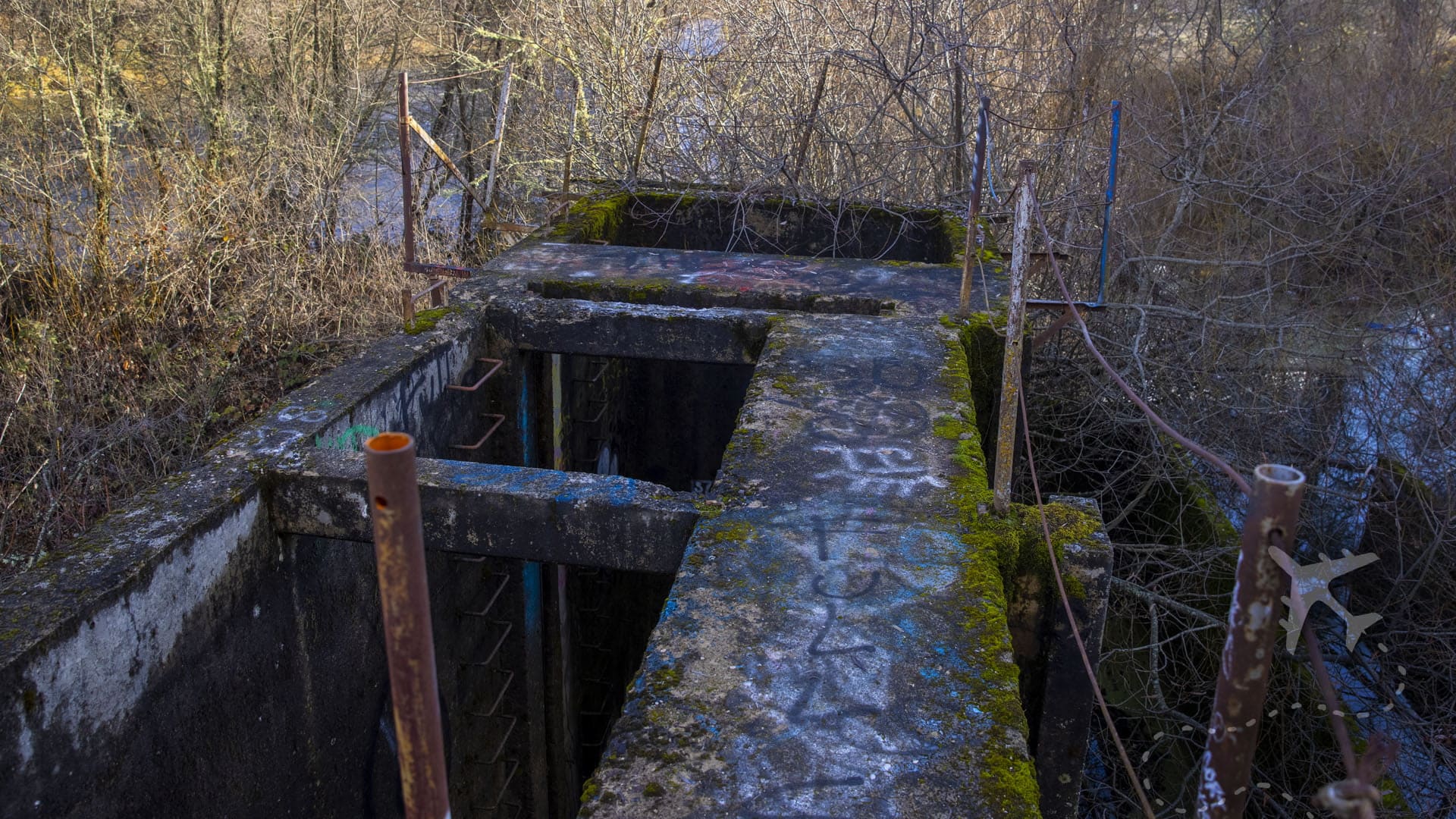
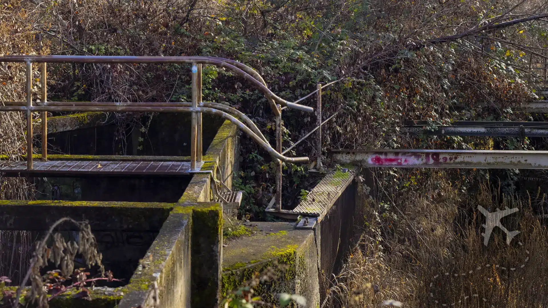
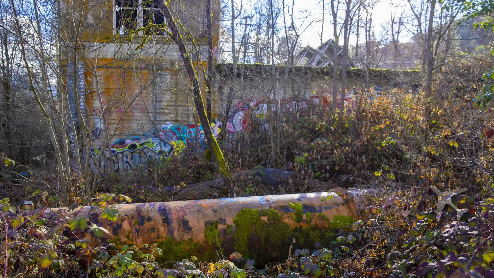
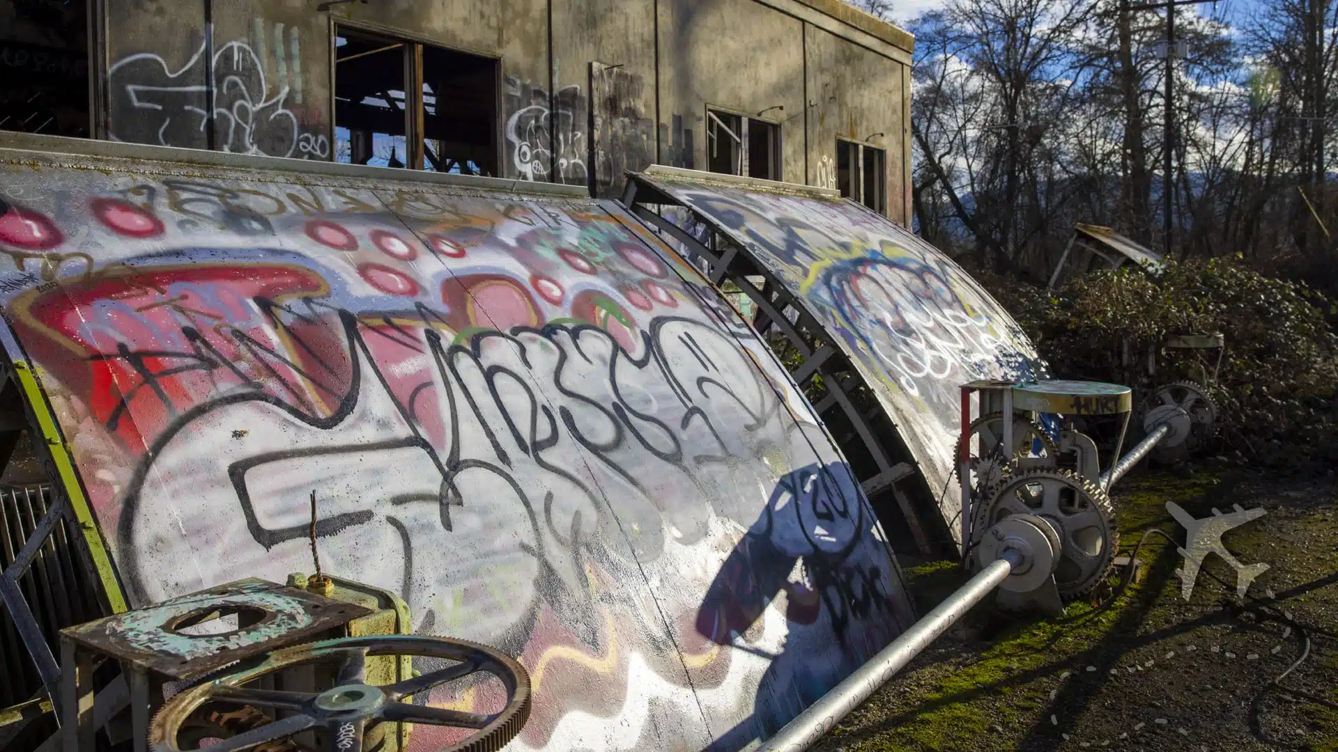
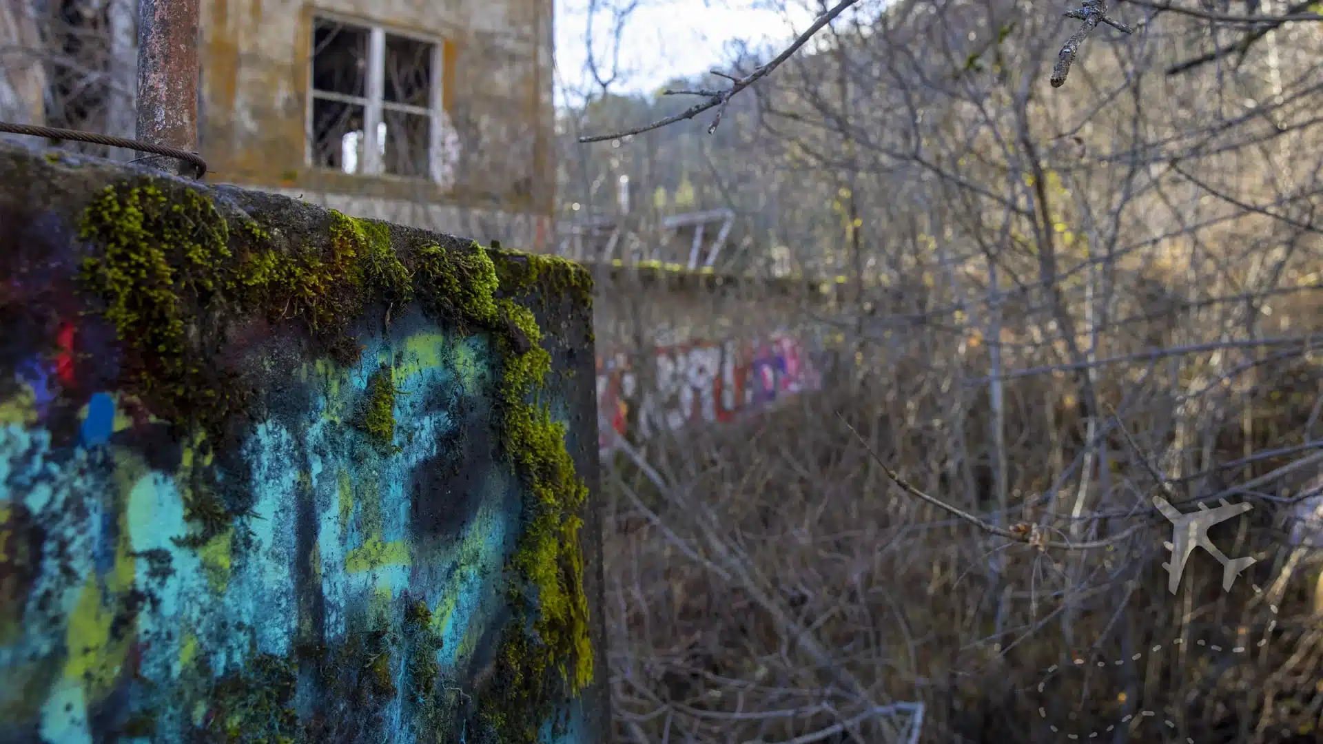
Interestingly, the engineering plans went into great detail on protecting the fish, carefully removing the concrete dam structures, and returning the river banks to their former glory. The engineers left behind or ignored the diversion sluice superstructure next to the Gold Hills Sports Park on Highway 234. Nature has since taken over, with vegetation creeping across the ruins and wildlife returning to the area.
A Dark Tourism Attraction
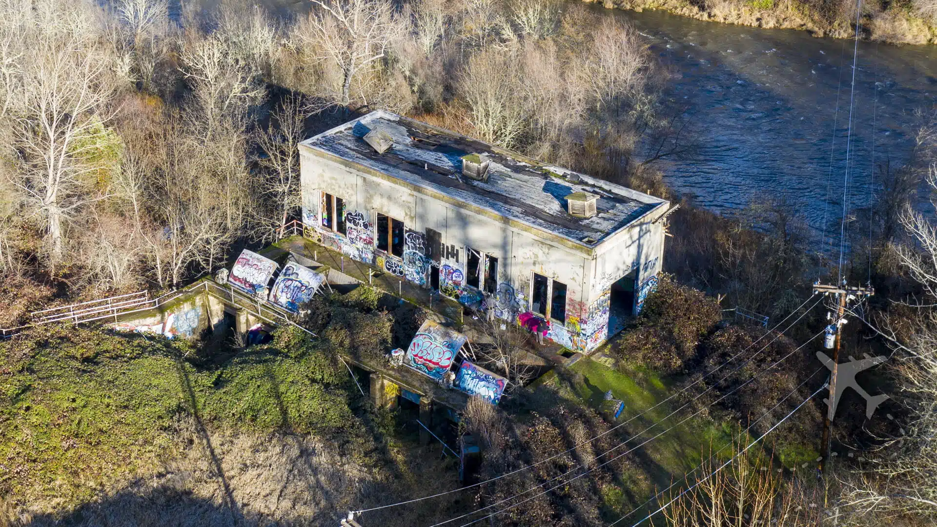
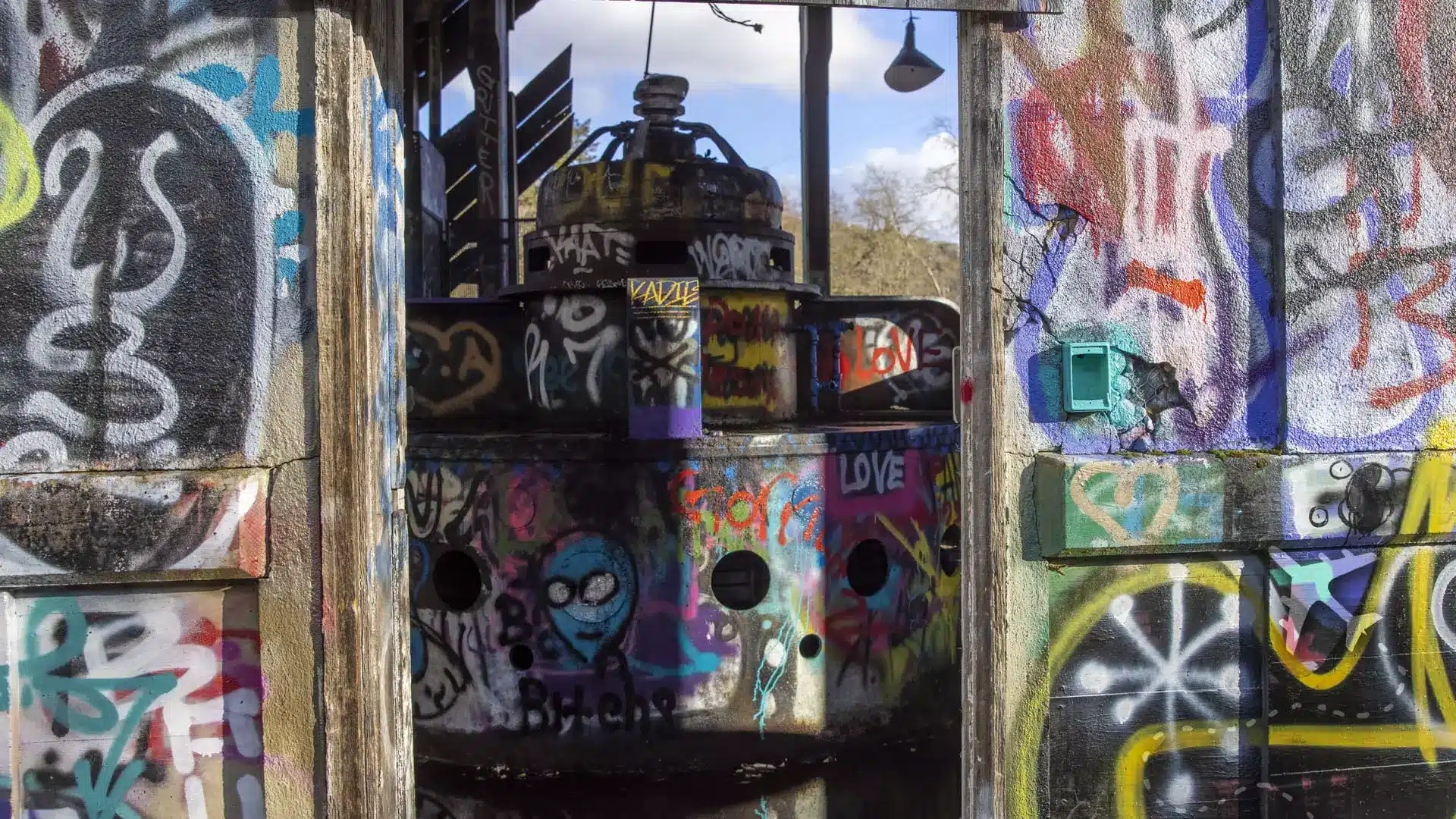
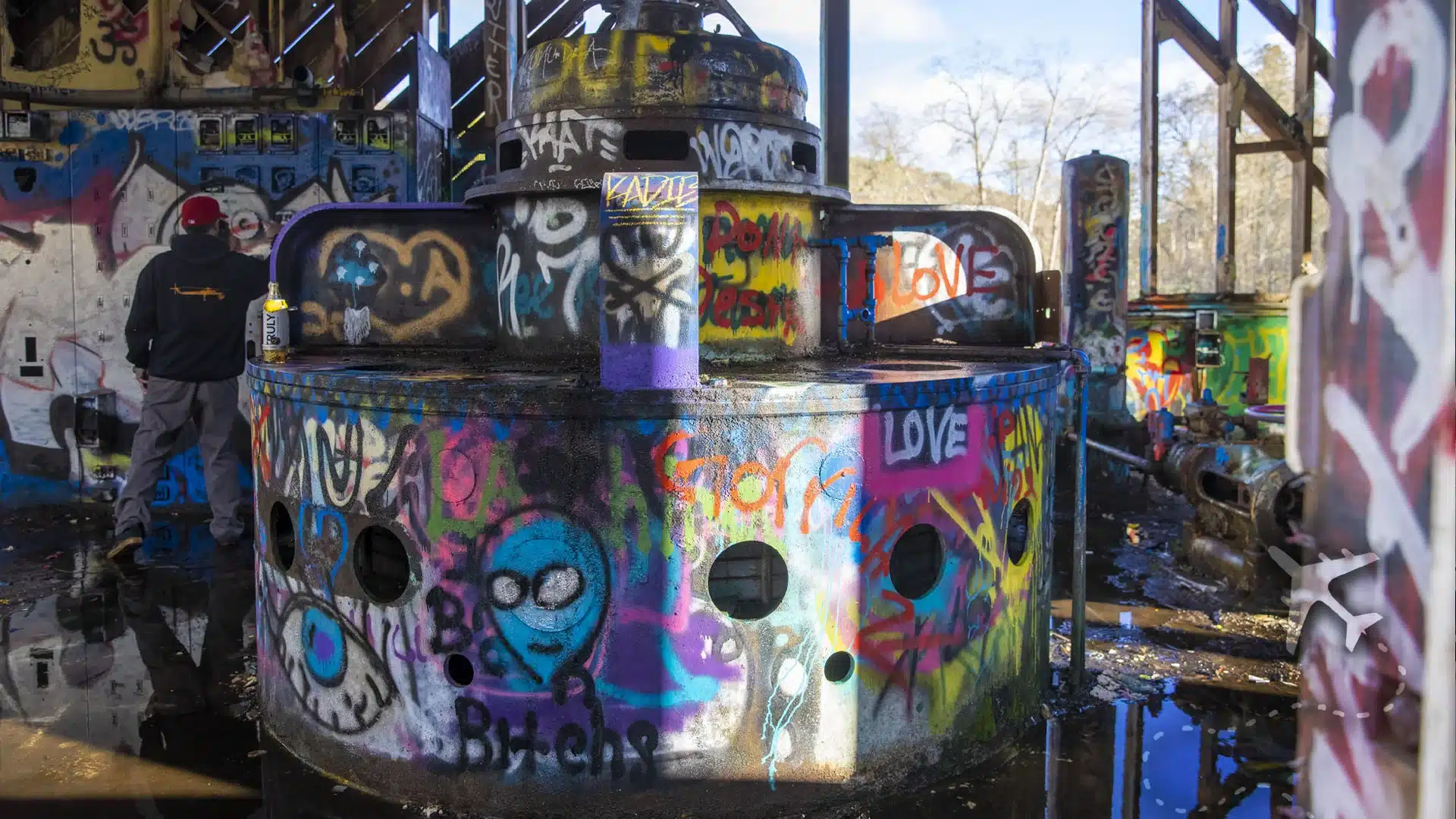
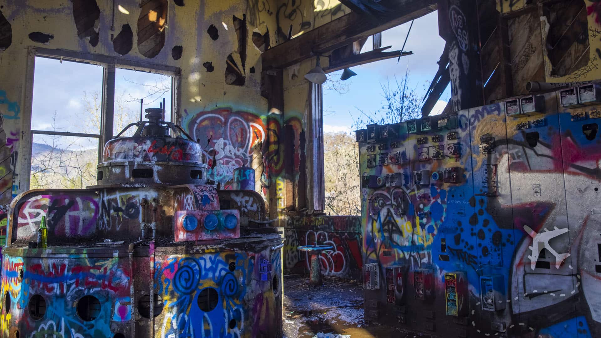
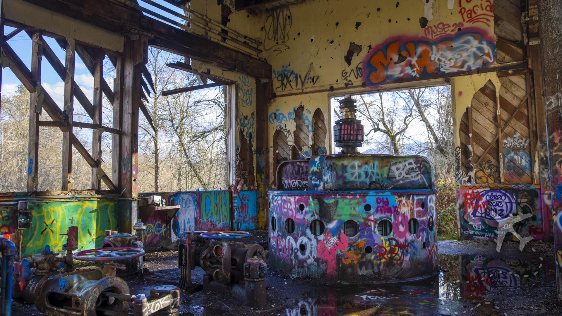
For dark tourism enthusiasts, Gold Hills Dam is a jackpot of eerie vibes and Instagram-worthy decay. Much like Centralia’s Old Highway 61, The Gold Hill dam sluice is wholly abandoned, decaying, and will one day collapse. It has become a daily graffiti magnet for artists to show their work. Each day, the dilapidated pump house is coated with countless cans of spray paint, and the pump house is decorated with sluice gates and retention areas with spontaneous creativity.

Locals often tell ghost stories about the area, with whispers of shadowy figures and unexplained sounds around the old floodplain. Whether you believe in the supernatural or love a good spine-tingling tale, it adds another layer of intrigue to your visit.
Visiting Gold Hills Dam
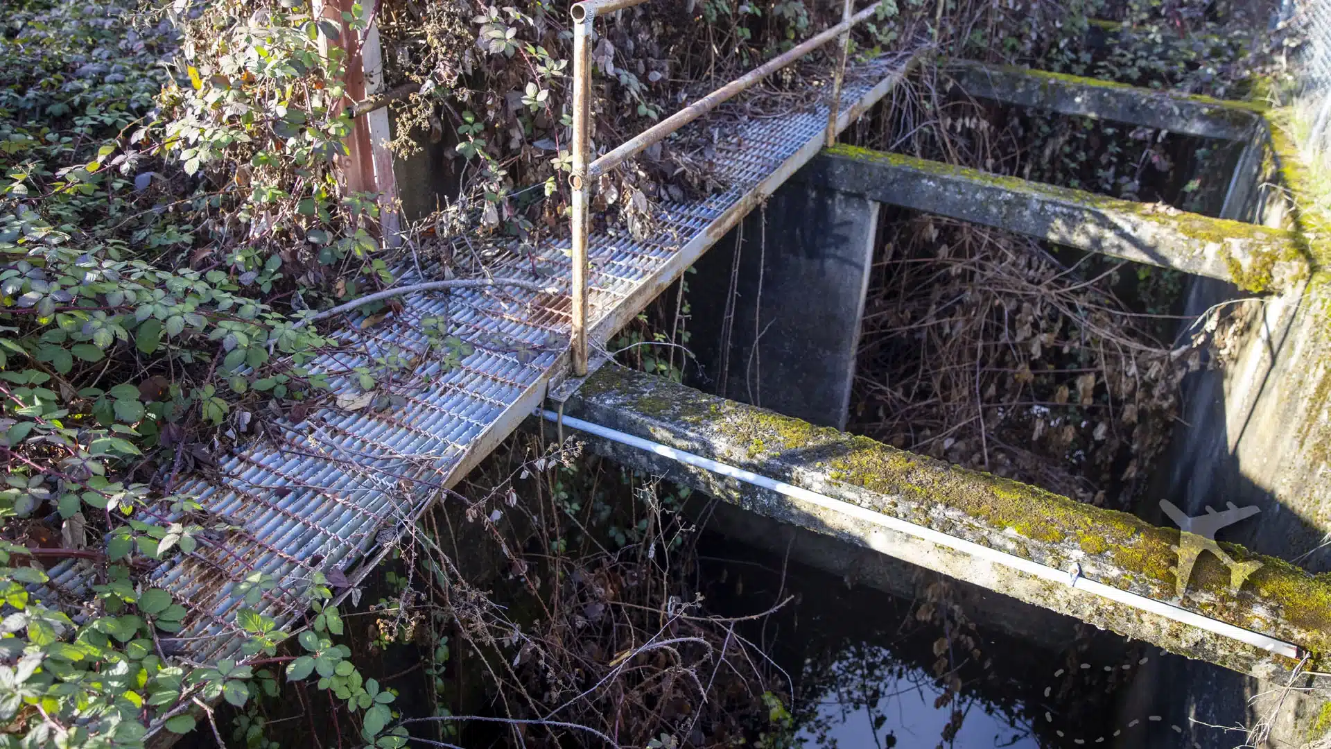
Getting to the site is half the adventure. A winding dirt road leads through dense forests, eventually opening up to the stark ruins of the dam. There are no marked paths; you can barely see the building over the bushes along the hiking trail adjacent to Highway 234. Wear sturdy shoes; you’ll scramble over rocks and uneven ground for the best views.
Once you figure out how to get there, the Gold Hills dam pump house has gaping holes in the walls facing the Rogue River. The roof has signs of imminent collapse, and no signs warning of the danger have been posted.
While there are no formal tours, local guides are often available for hire, and they’ll give you the lowdown on the dam’s history, the disaster, and the area’s eerie reputation. If you’re planning to stay nearby, pack for a rustic experience. The closest accommodations are small bed-and-breakfasts or campsites, perfect for embracing the remote, haunting vibe of the place.

Gold Hills Dam Uncensored: Final Thoughts
Gold Hills Dam isn’t your typical vacation spot; it’s raw, unsettling, and unforgettable. As you stand before its towering remnants, you’ll feel the weight of its history: the lives it shaped, the disaster it caused, and the wild reclamation that followed. This is dark tourism at its finest, a chance to connect with a place where ambition collided with reality and nature emerged victorious.
Pack your gear, steel your nerves, and get ready to explore one of the most badass abandoned sites you’ll ever set foot on.
